Storm conditions push backcountry avalanche hazard to considerable
By Timothy Schafer, The Nelson Daily
Although avalanche conditions in the West Kootenay backcountry have been moderate for the last few days they will climb to considerable Wednesday as new snow and wind will set up touchy wind slabs near ridge tops, the Canadian Avalanche Centre reports.
James Floyer of the CAC said anticipated snowfall amounts have gone up for this region, enough to raise the avalanche hazard to considerable for alpine and tree line areas on Wednesday as storm conditions settle in.
The hazard could to return to moderate for Thursday and Friday, but those weather patterns are poorly defined by the weather models and are unpredictable, said Floyer.
Around 10-15 centimetres of new snow will fall Wednesday with 60-80 kilometre-per-hour westerly winds at the ridge tops. The freezing level will be around 1,700 metres.
No recent avalanche activity has been reported, although Floyer anticipated activity would ramp up during the approaching storm.
“The principal mischief makers right now are rapidly developing wind slabs and unstable cornices,” he wrote in his report.
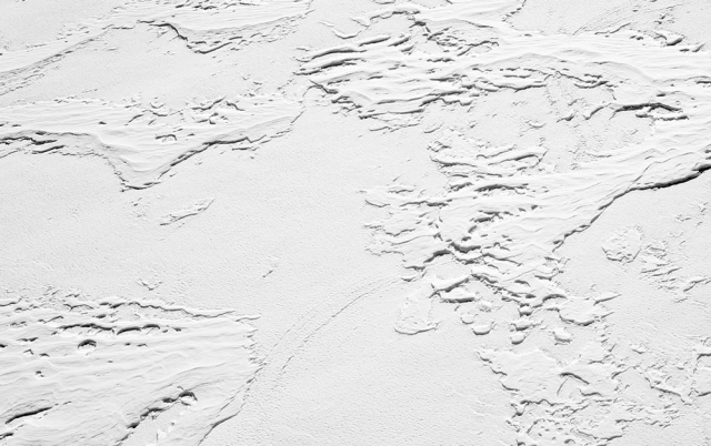
Wind slab is identified by seeing ripples and furrows in otherwise smoothed over snow. Often the snow surface looks “pillowy,” said Floyer, but when you ride into it the snow feels relatively dense.
A wind slab on a steep slope is a problem, as well. Therefore, don’t drop in off a ridge or into a steep gully if you see wind slab, Floyer advised.
“If you’re riding up from below, turn back down slope before you run into trouble near the ridge crest,” he said.


