Pile burning south of Revelstoke may cause smoke

By Contributor
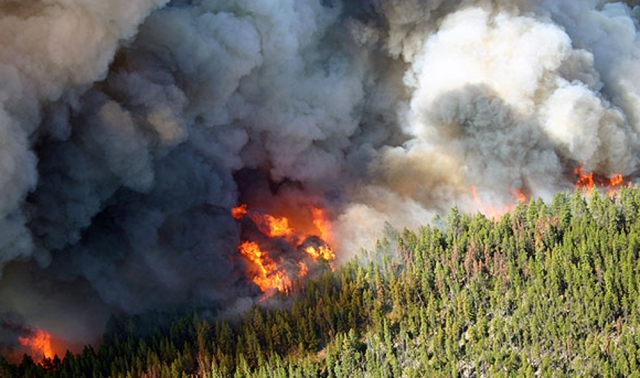
If you spot a fire or smoke south and west of Revelstoke, it is likely due to prescribed pile burning.
The Ministry of Forests, Lands and Natural Resource Operations is planning to burn slash piles created from a fuels management project that took place in spring 2011.
Burning will proceed only if weather conditions are ideal for quick smoke dissipation. Wind speed, direction, venting and burning conditions will all be considered prior to ignition to minimize smoke.
Smoke and flame may be visible from some locations in the Macpherson nordic ski area along Highway 23 and Begbie Falls Road. Trained wildfire crews and equipment will be on site monitoring the burning.
The goal of the fuels management project is to reduce forest fuels in interface areas, ultimately limiting the risk of catastrophic wildfires.
This area was also chosen to provide residents of the Columbia Shuswap Regional District an opportunity to view a typical Fire Smart forest and provide a model on which to base their own property modifications.
Quick facts
- Burn scars will be cleaned up and any remaining materials scattered to reduce visual impacts.
- The fuels management project included removing danger trees, thinning stands, clearing fuels on the forest floor, limbing trees to two metres in height to remove ladder fuels and removing unhealthy, suppressed trees.
- More information on fuels management and FireSmart can be found at: http://bcwildfire.ca/Prevention
- To report a wildfire or unattended campfire, call *5555 on your cellphone or toll-free to 1 800 663-5555.