UPDATED: Evacuation alert for Grand Forks/Christina Lake area lifted
The Regional District of Kootenay Boundary has lifted the Evacuation Alert for areas of Electoral Area D south of the Kettle River, Industrial/Ruckle area of the City of Grand Forks, and the Cascade/Ponderosa area of Christina Lake/Electoral Area C. For the most up to date information visit rdkb.com or follow @AlanLStanley ...
Island cop injured, police cars destroyed by suspect armed with SUV
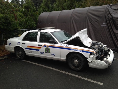
Salt Spring Island – Shortly after 12 a.m. on Aug. 29th, officers with the Salt Spring Island RCMP were conducting an impaired driving checkpoint in the 100 Block of Upper Ganges Road, when a man driving a Chevrolet Blazer attempted to avoid the checkpoint, nearly striking an officer who was on foot. A police car, stationary on the roadway at the time, was […]
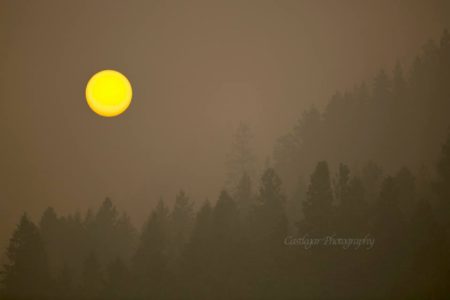
On again, off again smoky skies advisory back off again says Environment Canada
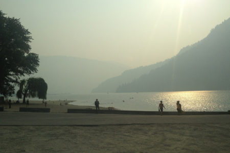
Rain has reduced the smoke in the West Kootenay/Boundary region to allow Environment Canada to halt the smoky skies advisory Monday afternoon. On again, off again smoky skies advisory back on again says Environment Canada Environment Canada has re-issued the smoky skies advisory for Boundary and Kootenay areas as of Monday....
SE Fire Centre asks hunters to stay away from wildfire areas; provides regional fire update
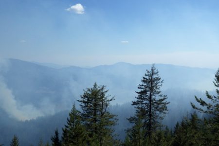
The volatility of the wildfire season has prompted the Southeast Fire Centre to ask hunters to stay away from areas with active wildfires. "Hunting season begins on Sept. 1, and hunting in the vicinity of a wildfire could put the safety of firefighters at risk," the Southeast Fire Centre said in a media release. The Southeast...
FortisBC restores power to residents impacted by wildfire near Rock Creek
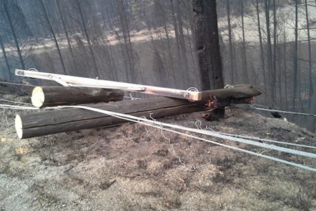
In a media release Friday, FortisBC said the company has now restored permanent power to residents impacted by the Rock Creek fire and is working proactively to address potential fire impacts in the areas of Grand Forks and Christina Lake. "FortisBC completed the rebuilding of the fire-damaged 10-kilometer main line between...
New season starts for Trail sea cadets
September 15 brings the start of the Sea Cadet Training Year for the 131 Kootenay Royal Canadian Sea Cadet (RCSCC) Corps in Trail. The cadets and their staff would like to invite the public to participate in their “Open Ship” night, to be held at the Trail Armoury – 1990 7th Ave., Trail – from 5 to 8 p.m. There will be...
Wildfire Update for Friday, Aug. 28

Lynch Creek: · This fire is located 25km north of Grand Forks and is approximately 250ha and 15% contained. · Today, crews are working on containment of the south and west flanks. · This fire is currently not threatening any structures or communities; however smoke from this fire is visible to the...
RDCK fire fighters pitch in at Christina Lake in case Stickpin fire causes local starts
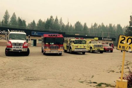
The Regional District of Kootenay Boundary structural protection crews have been supplemented with additional resources from our resource partners in the Regional District of Central Kootenay and the Kootenay Boundary Regional Fire Rescue. Fourteen firefighters brought four fire engines and two tenders to the Christina Lake...
Thursday wildfire update from EOC
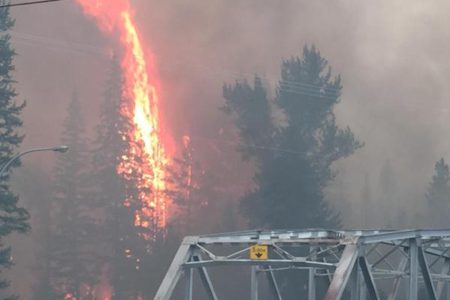
Wildfire Update for August 27, 2015. Lynch Creek: · This fire is located 25km north of Grand Forks and is approximately 250ha and 15% contained. · The BC Fire Service is working on containment of the east flank of this fire. · This fire is currently not threatening any structures or communities, however...
Harmony Choir seeks new members for exciting year

Trail & District Harmony Choir welcomes new members to sing with us as we begin our 2015-2016 season on Sept. 9. We are a non- auditioned, mixed comm, we enjoy an atmosphere of fun and friendship, while also focussing on the music in order to perform to the best of our abilities in concerts several times a year. We practice...