More smoke visible from Harrop Creek wildfire; new McCormick Creek blaze a concern
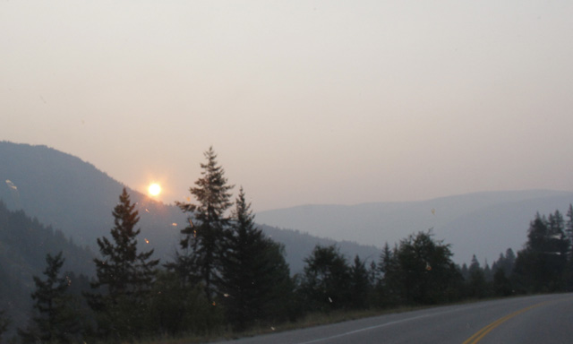
Extra smoke in the valley may have been compliments of a spot fire outside the perimeter of the Harrop Creek wildfire the Southeast Fire Centre said in a media release Wednesday.
“More smoke may be seen coming from the Harrop Creek wildfire today (Aug. 9, 2017), as BC Wildfire Service personnel respond to a 15-hectare spot fire that is 750 metres outside of the main fire perimeter,” the Southeast Fire Centre release said.
The Southeast Fire Centre said these fires, approximately 10 kilometres south of the communities of Harrop and Procter, as of Wednesday (August 9) afternoon, covered an estimated 2,136 hectares.
The fires continue to burn in difficult terrain and producing a lot of smoke that may be visible from nearby communities.
However, neither fire is currently threatening any communities or structures.
“The spot fire occurred northeast of the main fire perimeter and is now burning toward the south and back into the main fire,” the Southeast Fire Centre release said.
“Sixty BC Wildfire Service personnel continue to build fire guards with the support of three helicopters and three pieces of heavy equipment.”
The Harrop Creek wildfire is not the only fire of concern in the Southeast Fire Centre west region.
Wednesday, BC Wildfire Service responded to a fire 26 kilometres south of Trail in the Pend d’Oreille area — the McCormick Creek fire, which started Tuesday evening.
The wildfire, which can be seen from motorists traveling Highway 6 near the Canada/USA border, is now estimated to be 74 hectares in size, ballooning from its original four hectares when first reported.
Cause of the interface fire remains under investigation with 20 firefighters, four helicopters, four air tankers and one piece of heavy equipment battling the blaze. It is burning in steep terrain close to power lines and is exhibiting aggressive fire behaviour. Due to potential safety risks, ground crews were relocated to safer ground, but they continue to work on this fire.
As a precautionary measure, the Regional District of Central Kootenay issued an evacuation alert on Aug. 9, 2017. For more information about this alert, people should call 250 352-7701 or visit the district’s website at www.rdck.ca.
The smoke covering the most southern areas for BC has forced the Ministry of Environment & Climate Change Strategy, in collaboration with the Interior and Northern Health Authorities, to continue its Smoky Skies Bulletin that was last updated on Monday August 07 due to changing smoke conditions.
Areas now covered by this Bulletin include: 100 Mile, Arrow Lakes, Boundary, Bulkley Valley and The Lakes Northwest (including Smithers), Bulkley Valley and The Lakes Southwest (including Burns Lake), Cariboo North, Cariboo South, Chilcotin, East Columbia, East Kootenay, Elk Valley, Fraser Canyon, Kinbasket, Kootenay Lake, Nicola, North Coast – Coastal Sections, North Coast – Inland Sections, North Columbia, North Thompson, Okanagan, Prince George, Shuswap, Similkameen, Slocan Lake, South Thompson, West Columbia, West Kootenay, Williston, Yellowhead, and Yoho Park-Kootenay Park.
Smoke concentrations will vary widely as winds, fire behaviour and temperatures change.
Avoid strenuous outdoor activities. If you are experiencing any of the following symptoms, contact your health care provider: difficulty in breathing, chest pain or discomfort and sudden onset of cough or irritation of airways. Exposure is particularly a concern for infants, the elderly and those who have underlying medical conditions such as dia betes, and lung or heart disease.
The Southeast Fire Centre extends from the U.S. border in the south to the Mica Dam in the north and from the Okanagan Highlands and Monashee Mountains in the west to the B.C.-Alberta border in the east. The Southeast Fire Centre includes the Selkirk Natural Resource District and the Rocky Mountain Natural Resource District.
To report a wildfire or open burning violation, call *5555 on a cellphone or 1 800 663-5555 toll-free. For the latest information on current wildfire activity, burning restrictions, road closures and air quality advisories, visit: www.bcwildfire.ca
You can also follow the latest wildfire news:
* On Twitter: http://twitter.com/BCGovFireInfo
* On Facebook: http://facebook.com/BCForestFireInfo


