Fire and Smoke Update from Southeast Fire Centre

By Southeast Fire Centre
The Southeast Fire Centre has issued the following bulletin:
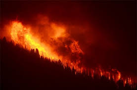
BC Wildfire Service personnel are currently responding to 25 lightning-caused wildfires throughout the Southeast Fire Centre. Although some of these fires are highly visible from surrounding communities, none of them is immediately threatening communities or structures.
These fires include the following:
* Four separate fires are burning about five kilometres northwest of Nakusp in the Turner Creek and Dunn Creek area. These fires all cover fewer than 0.5 hectares. One helicopter and 13 firefighting personnel are currently on site.
* One initial attack crew and one helicopter are responding to a 0.04-hectare fire about 15 kilometres northeast of Nelson in the Duhamel Creek area.
* There are four fires burning on the east side of Arrow Lake, from five kilometres to 21 kilometres southeast of Burton. All of these fires cover less than one hectare and are burning in remote terrain. Firefighting crews are responding to all of them.
* One 0.04-hectare fire is burning in the Mather Creek area about 15 kilometres north of Kimberley. Firefighting crews are responding.
The BC Wildfire Service is urging the public to abide by the campfire prohibition that came into effect on July 7, 2017. This restriction on campfires is to help reduce the number of human-caused wildfires, which can divert critical resources from naturally occurring wildfires. The Southeast Fire Centre has responded to a total of 86 fires since April 1, 2017, 28 of which were human-caused and therefore preventable. By comparison, the total number of wildfires as of this date last year was 44.
Most of the smoke that is visible in many areas of the Southeast Fire Centre is coming from several large fires that are burning in the Cariboo Fire Centre, the Prince George Fire Centre and the Kamloops Fire Centre. That smoke is expected to continue moving through this region, so long as the prevailing winds come from the west.
The Southeast Fire Centre extends from the U.S. border in the south to the Mica Dam in the north and from the Okanagan Highlands and Monashee Mountains in the west to the B.C.-Alberta border in the east. This includes the Selkirk Natural Resource District and the Rocky Mountain Natural Resource District.
For information on air quality, as well as smoke forecasts for Western Canada, visit the BC Air Quality website: www.bcairquality.ca/bluesky/west/index.html
To report a wildfire or open burning violation, call *5555 on a cellphone or 1 800 663-5555 toll-free. For the latest information on current wildfire activity, burning restrictions, road closures and air quality advisories, visit: www.bcwildfire.ca
You can also follow the latest wildfire news:
* on Twitter: http://twitter.com/BCGovFireInfo
* on Facebook: http://facebook.com/BCForestFireInfo