More than double snow accumulation for February
February saw almost 2.5 times the normal monthly snowfall for the West Kootenay region said Ron Lakeman, Weather Forecaster for the Southeast Fire Centre in Castlegar in the monthly synopsis.
Lakeman said even though there was a general trend towards drier conditions during the second half of February, the month end snowpack of 40 centimetres is much deeper than normal.
“Three factors are responsible for this were higher than normal snowpack at the beginning of the month; cooler than average temperatures — the mean monthly temperature was -1.9 degrees, compared to the normal of -0.1 — and almost 2.5 times the normal monthly snowfall — 63.2 cm comparted to the normal monthly total of 25.7 cm.”
Lakeman said a cold and dense airmass that settled into the valleys of the West Kootenay towards the end of January helped maintain cold temperatures for the first half of the month as several Pacific frontal systems passed over the area.
He said 55.2 centimetres of snow fell within the first nine days of the month with reports of even greater accumulations, up to 80 cm, in some nearby areas.
“The greatest one day snowfall of 14.0 cm occurred during the night of the 5th, a value roughly half the record maximum daily snowfall during February of 27.7 cm from Feb 8, 1969,” he said.
“The amount of snow on the ground peaked at 69 centimetres on the 10th, the greatest local snowpack since Jan 2009.”
Lakeman said an intense Pacific system that tapped into a feed of moisture originating off the coast of Oregon/California brought warming temperatures and 29.4 millimetres of rain during the middle of the month and more so the night of the 15th.
“(This broke) the record for the greatest one day rainfall during February, the previous maximum was 26.2 mm from February 25th 1979,” he said.
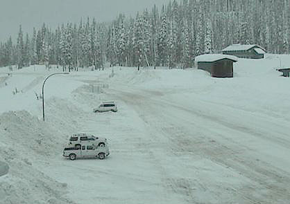
The beginning of March sees a high accumulation of snow in the mountain pass areas for the next week with the weather alternating between rain and snow in the valley bottoms.
Enivronment Canada has called for a snowfall warning for Highway 3 with total amounts of 20 to 30 cm is expected.
“An approaching weather system will spread snow today along Highway 3 between Paulson Summit to Kootenay Pass and the Trans Canada Highway between Eagle Pass to Rogers Pass,” the Environment Canada website said.
Road conditions are available at DriveBC.


