RDCK issues evacuation alerts for Syringa, near Deer Park, along Arrow Lakes area and parts of Robson

By Castlegar Source
The Regional District of Central Kootenay (RDCK) has issued Evacuation Alerts for two areas:
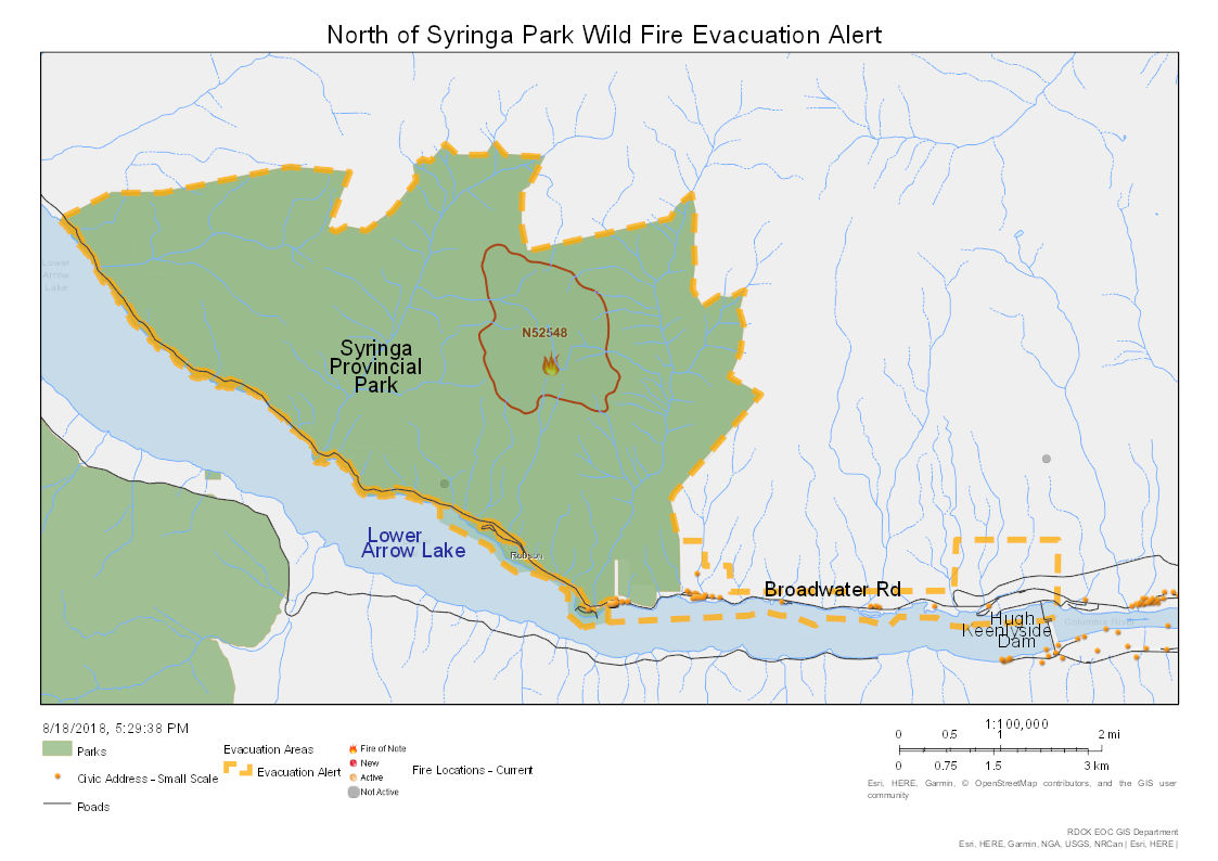
· All of Syringa Provincial Park and southeast along Lower Arrow Lake to the Hugh Keenleyside Dam in Robson. The alert covers a large area and includes 26 residential addresses—including the Waterfront at Arrow Lake which has 57 units—and a popular campground with approximately 100 camp sites.
· The area from south of Deer Park at Cayuse Creek, northwest along the lake to the end of Broadwater Road, and north to the end of Deer Creek Forest Service Road. The alert covers 77 residential addresses.
Maps of the alert areas are attached, and can also be found on the RDCK website here.
“The Southeast Fire Centre has requested the Evacuation Alerts as a precaution to protect people and property in the area, particularly campers or visitors to the area,” said Sangita Sudan, Director of the RDCK Emergency Operations Centre (EOC). “If you are affected by the alert, please take the time now to prepare to evacuate yourself and your family should an evacuation be required.”
Under an Evacuation Alert, residents and visitors should be prepared to evacuate at a moment’s notice. It is recommended to prepare an emergency kit and ensure preparedness in the event that the situation worsens, and an Evacuation Order is enforced.
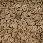
The North of Syringa Park wildfire (N52548) was discovered on August 11, and is now an estimated 419 hectares. BC Wildfire Service considers it a Fire of Note. The Deer Creek wildfire (N52489) was discovered on August 11, and has grown to approximately 225 hectares.
On the opposite shore of Lower Arrow Lake, the Bulldog Mountain wildfire (N52497)—formerly the South of Renata Creek wildfire—is currently estimated at 605 hectares. The evacuation alert for the area—from Renata down to Shields—remains in effect. Residents and visitors should be prepared to evacuate if required. The Evacuation Order for the Sheep Creek Road area southeast of Salmo remains in effect due to the McArthur Creek wildfire (N51557). Anybody in the area should evacuate to ensure their safety.
Updates will be provided via the RDCK website, The Source, Facebook and Twitter as more information becomes available.
For more information:
· Current RDCK Evacuation Alerts, Orders and Rescinds: https://rdck.ca/EN/main/services/emergency-management/evacuation-order-and-alert-page.htmlor call 250-352-7701 / 1-866-522-7701.
· Sign up for RDCK Emergency Notification System to receive notification of Evacuation Orders. Go to ww.rdck.caand select “Emergency Alerts” from the home page, or go to the notification system sign-up page at https://rdckemergency.connectrocket.com.
· BC Wildfire – Interactive Map of Current Fires: http://governmentofbc.maps.arcgis.com/apps/MapSeries/index.html?appid=ef6f11c8c36b42c29e103f65dbcd7538
· Public weather alerts for BC from Environment Canada: https://weather.gc.ca/warnings/index_e.html?prov=bc
· Highway closures and conditions from DriveBC: http://www.drivebc.ca/
· For the BC Air Quality Health Index: http://www.env.gov.bc.ca/epd/bcairquality/readings/aqhi-table.xml
· For tips about living with smoky skies and wildfires from the Interior Health Authority: https://www.interiorhealth.ca/YourEnvironment/Emergency/MajorEvents/Pages/default.aspx
· Emergency preparedness information and tips from the Prepared BC website: https://www2.gov.bc.ca/gov/content/safety/emergency-preparedness-response-recovery/preparedbc